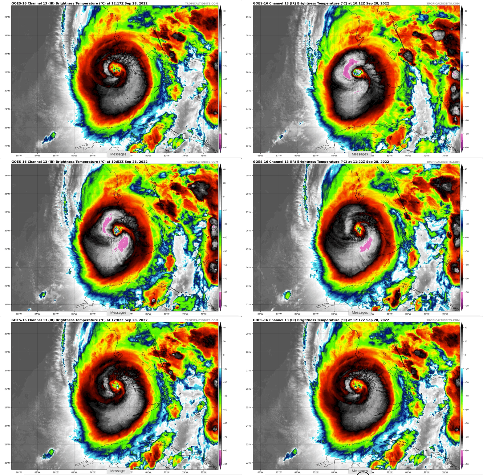
*****Slow-moving and catastrophic Hurricane Ian impacts Florida...extreme rainfall/damaging winds/isolated tornadoes/dangerous storm surge...heavy rain/strong winds to move up thru eastern US*****
Paul Dorian
Hurricane Ian has attained category 4 status and will have a very significant impact on Florida from today into Thursday. Images courtesy NOAA, College of DuPage
Overview
In a storm that will rival the great hurricane of 1921 for its impact on west-central Florida, Hurricane Ian has climbed to category 4 (“major”) status and will unfortunately likely have a devastating impact on the state from today into Thursday. Although there is some wind shear in the vicinity of the storm, Hurricane Ian is large, powerful, and a slow-mover which will exacerbate the effects of torrential rain, powerful winds and a dangerous storm surge on the western side. The hurricane will cross central Florida and then ride up just off the northeast Florida coastline and likely return as a tropical storm somewhere near the Georgia/South Carolina later Friday. The remnant heavy rain and strong winds of Ian will push up through the eastern US late this week and this weekend with impacts all the way to the Mid-Atlantic region.
Tremendous rainfall amounts will occur in Florida with slow-moving Hurricane Ian and its remnants will generate heavy rainfall and strong winds up through the eastern states late this week and weekend. Map courtesy NOAA/WPC
Details
Hurricane Ian has reached “major” hurricane category 4 status as it churns towards west-central Florida. Sustained winds this morning have reached 155 mph and the movement is to the NNE at only 10 mph. Hurricane Ian will remain a slow-mover and this will only exacerbate its likely devastating impact with a longer period of damaging winds, a longer period of extreme rainfall (2 or 3 feet possible in spots), and a longer period of a water buildup over the Gulf setting the stage for dangerous storm surge which will be at its worst just to the south or right of its landfalling position - perhaps as high as 12-16 feet from around Englewood to Bonita Beach.
At the end of the week, strong high pressure will build into the northeastern part of the country and this system will become a big player. Hurricane Ian is likely to cross Florida over the next 24-36 hours, re-emerge just off the northeast Florida coastline, and then return to the Georgia/South Carolina later Friday as a tropical storm. Given very strong high pressure to the north over the Northeast US, a strong pressure gradient will help to generate strong winds up through the eastern states late this week and weekend with heavy rainfall as well. The threat of the strong winds and heavy rain will go all the way up to the Mid-Atlantic region this weekend.
Meteorologist Paul Dorian
Arcfield
arcfieldweather.com


