***Relentless cold pattern Alaska to Mid-Atlantic...coldest night so far on the way for DC, Philly, NYC...another frigid air mass headed to the US for the late week/weekend...snow threats as well***
Paul Dorian

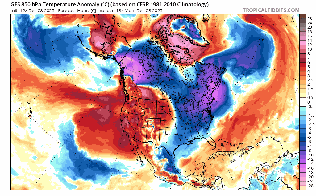
Cold air outbreaks will continue to dominate the corridor from Alaska to the Mid-Atlantic region during the next week or so. This loop of 850 mb temperature anomalies extends from mid-day today, December 8th to mid-day next Monday, December 15th. Maps courtesy NOAA (GFS), tropicaltidbits.com
Overview
The cold pattern that has brought relentless cold in recent days from Alaska to the Mid-Atlantic region will continue for at least another week or so. The new work week begins with some frigid air in the eastern states and overnight lows in the DC-to-Philly-to-NYC corridor will drop to their lowest levels of the season so far. “Clipper” low pressure systems will swing cold fronts through the northeastern states during the next few days limiting any chance for a sustained warmup. One “clipper” can bring rain, ice and/or snow to the Mid-Atlantic/Northeast US at mid-week and a second system can bring a touch of snow in the late week. Over the weekend, low pressure may ride along the Arctic boundary zone, and this system could bring some accumulating snow to the Mid-Atlantic region to go along with the well below-normal temperatures that should last into the early part of next week.
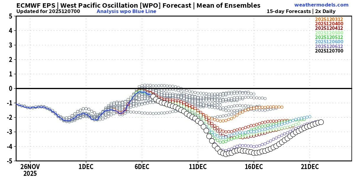
One teleconnection index that signals more cold ahead for the central and eastern US is known as the West Pacific Oscillation (WPO). When this index drops into “negative” territory this time of year for a sustained period, it is usually correlated with colder-than-normal weather over much of the central and eastern US. Map courtesy ECMWF, weathermodels.com
Details
The month of December has started off on the cold side across much of the Mid-Atlantic region and Northeast US and another far below-normal air mass has pushed into the area following the overnight passage of a cold front. Temperatures today are struggling to pass the freezing mark in much of the DC-to-Philly-to-NYC corridor and a stiff breeze is making it feel even colder than the actual outdoor air temperatures. Temperatures later tonight will drop to the lowest levels of the season so far in most areas with the low-to-middle teens likely in many suburban locations just to the north and west of the big cities.

A frigid air mass is headed to the US from Canada for the late week/weekend and temperatures by Sunday morning will be well below-normal across a wide part of the country. The core of the coldest air mass this weekend - relative-to-normal - will be over the Upper Midwest where a deep snow cover still exists. Map courtesy ECMWF, weathermodels.com (Dr. Ryan Maue, X)
There will be moderation in temperatures at mid-week in the Mid-Atlantic/NE US as a “clipper” low pressure system passes by to the north (southwesterly low-level flow) and rain or perhaps a mix of rain, ice and snow will be possible in the DC-to-Philly-to-NYC corridor (snow likely for the interior). By late in the week, another “clipper” system can bring a touch of snow to the Mid-Atlantic region, and its associated cold frontal passage will simply reinforce the colder-than-normal air that will already be in place.
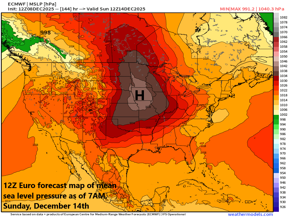
The frigid air mass that is headed to the US late this week and weekend will be anchored by very strong Canadian-born high pressure that moves to the central US by early Sunday. Map courtesy ECMWF, weathermodels.com (Dr. Ryan Maue, X)
Over the weekend, low pressure will try to organize and move from northwest-to-southeast along the Arctic boundary zone. This system will certainly have plenty of cold air to work with and it could produce some accumulating snow in the Mid-Atlantic region during the Saturday-to-Sunday time period...something to monitor in coming days.
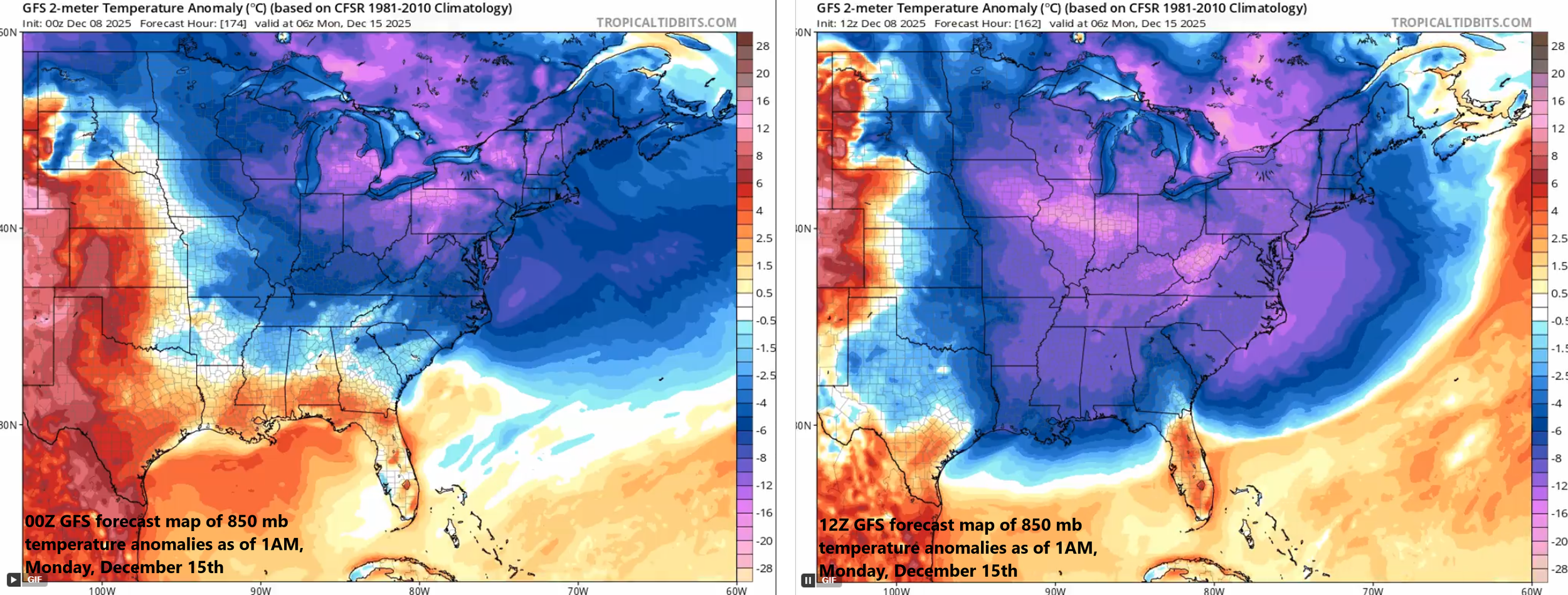
Computer forecast models have been underestimating these unrelenting cold air outbreaks and the one coming this weekend is no exception. The cold air outbreak as depicted by this morning’s (12Z) GFS model run (right) is more expansive and deeper than last night’s 00Z run (left)…we’ll see if this trend continues. Maps courtesy NOAA, tropicaltidbits.com
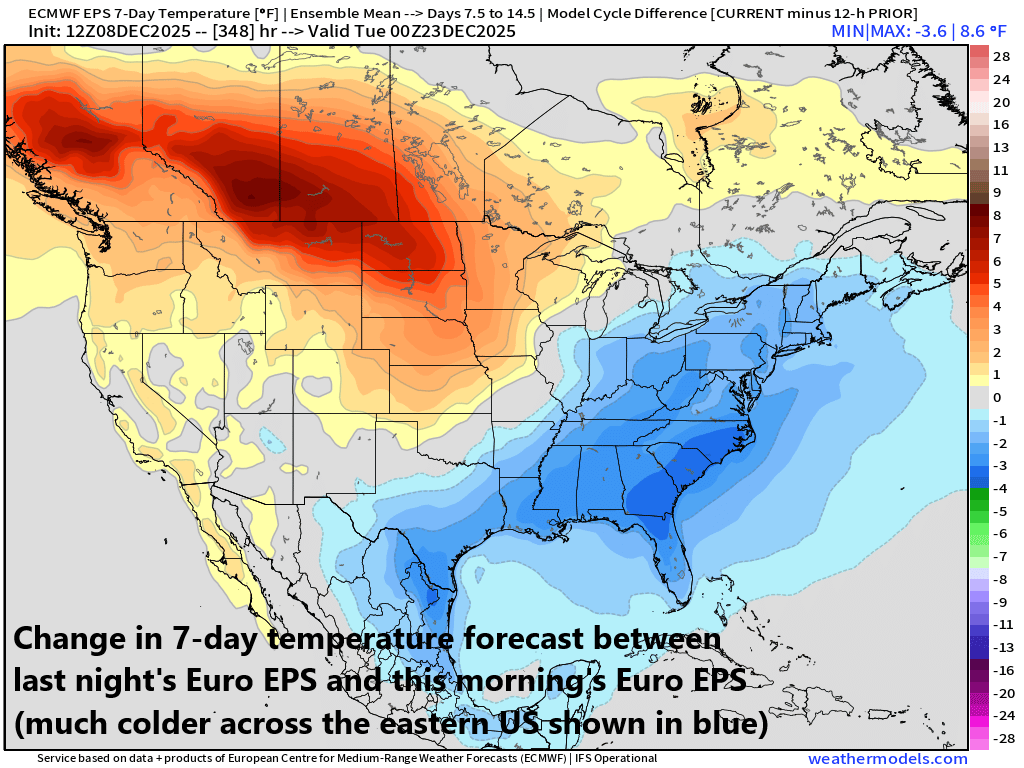
One final note, most computer forecast models have been underestimating these recent cold air outbreaks more than a few days in advance so it wouldn’t be a surprise if the cold weather for the next several days is more extensive than currently indicated by numerical prediction (potentially longer lasting as well).
Meteorologist Paul Dorian
Arcfield
arcfieldweather.com
Follow us on Facebook, Twitter, YouTube
Video discussion: