
****Face-slapping cold next few days...coldest yet coming to Florida...weekend storm impact appears greatest for portions of VA, NC, and along coastal sections farther to the north...stay tuned****
Paul Dorian
Overview
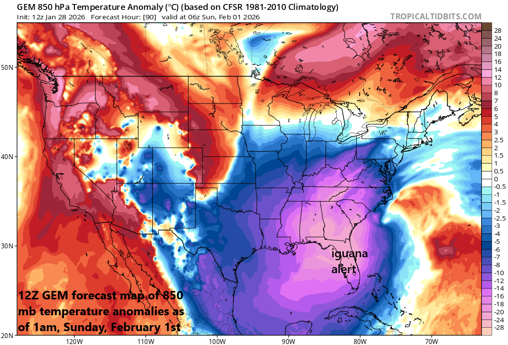
The next few days will produce some of the worst of the cold for the Mid-Atlantic region with overnight lows way down in single digits or even near the zero-degree mark. Some record low temperatures are likely during this 3-day bitter cold spell and there can be some record low high temperatures as well with afternoon highs generally confined to the teens in many spots. Later this weekend, a big push of Arctic will be into the Southeast US and Florida can experience near freezing temperatures all the way to Miami by Sunday morning (watch for falling iguanas).
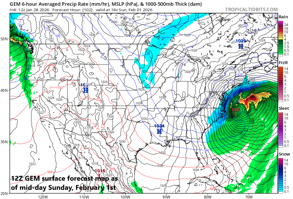
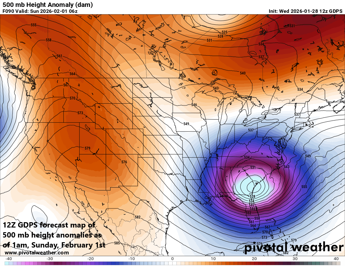
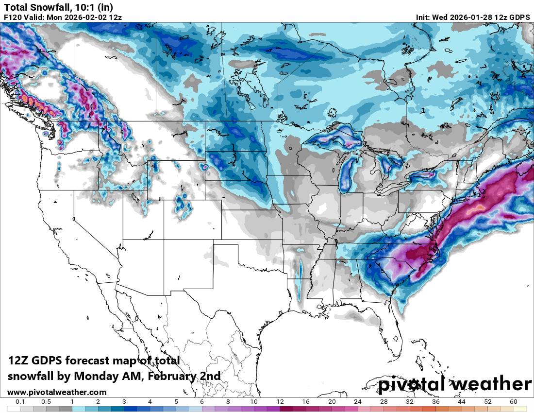
On the storm front, low pressure will develop near the Southeast US coastline on Saturday and then dramatically intensify as it moves over the western Atlantic Ocean somewhere to the east of the southern Mid-Atlantic region. The central pressure of this weekend storm could drop to similar levels as a category 2 or even category 3 hurricane and winds will become quite powerful. At this point, it appears the biggest impact from the weekend storm system will be confined to places like eastern North Carolina, southern Virginia, and the along coastal sections farther up the coast (e.g., New Jersey, Delmarva)…still a few days to go so stay tuned.
Details
The next few days will bring temperatures rarely seen in the Mid-Atlantic region with daytime highs confined to the teens or lower 20’s with below zero wind chills and overnight lows flirting with the zero-degree mark in many locations...even inside the I-95 corridor. A reinforcing Arctic air mass arrives later today, and it could bring some snow shower activity to the I-95 corridor and perhaps even a period of steadier snow across the DC metro region late in the day...watch for potential slick spots. The last time Philly Airport (PHL) and Reagan National Airport in Washington, D.C. (DCA) recorded temperatures below zero was in January of 1994, and the last time for Central Park (New York City) was in February 2016. The very cold conditions and bitter wind chills will persist through the remainder of the work week and beyond all because of a deep upper-level trough centered over eastern Canada. This system is allowing for repeated reinforcing shots of Arctic air that swing in from the north and west to the eastern states.
Other notes on the cold...record low temperatures and record low high temperatures are on the table during these next few days. For example, Philly’s record low temperature on Friday, January 30th is 7 degrees set in 2019, and the record low high temperature for that date is 18 degrees set in 1965...both are in jeopardy. In NYC, the longest stretch of below freezing days is 16 and this record may become in play. Finally, this cold pattern is impacting the southern states with the coldest air mass so far in Florida destined to arrive later this weekend. There were many places in the 30’s this morning across the “Sunshine State”, but it’ll be even colder later this weekend on the back side of a developing coastal storm. In fact, temperatures could drop to near freezing all the way down to Miami by Sunday morning...their lowest temperature ever is 27 degrees...watch out for falling iguanas.
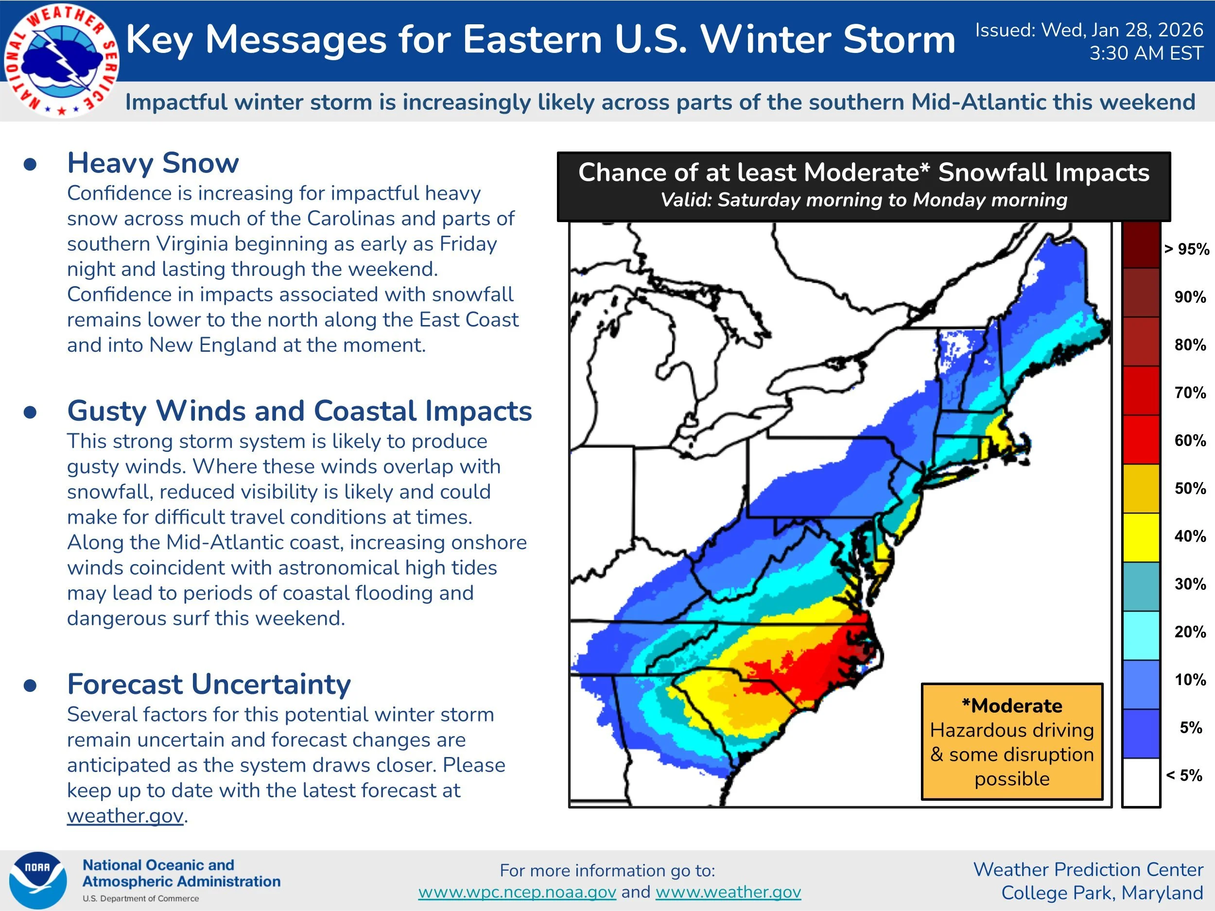
With respect to the weekend storm, it appears the biggest impact will be across portions of Virginia and North Carolina, and to coastal sections farther to the north. Low pressure will head towards the Carolina coastline on Saturday and then get juiced up by the phasing of a northern stream wave of energy and a southern wave. As a result, the low will intensify dramatically in a short period of time and winds nearby will become powerful. At this time, it appears the best snow will fall to the south and east of DC and Philly across southern Virginia and eastern North Carolina and along coastal sections up the coast (New Jersey, Delmarva Peninsula). If the storm were to “phase” a little bit sooner and to the west of current projections, then impacts could be greater in the I-95 corridor...still a few days away so stay tuned.
Meteorologist Paul Dorian
Arcfield
arcfieldweather.com
Follow us on Facebook, Twitter, YouTube
Vide discussion: