****Bitter cold extends all the way to southern Florida... explosive cyclogenesis this weekend...biggest impacts to the south and east of the DC-to-Philly-to-NYC corridor****
Paul Dorian

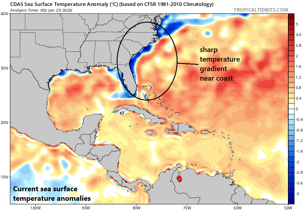
One of the catalysts for explosive cyclogenesis this weekend will be a sharp temperature gradient just off the eastern seaboard. Much colder-than-normal water is juxtaposed with the warmer than normal Gulf stream. Map courtesy NOAA, tropicaltidbits.com
Overview
The bitter cold weather pattern continues across the eastern states during the next few days with significant impacts reaching all the way down to southern Florida. In fact, the temperature will drop to near freezing in Miami by Sunday morning and zero-degree overnight lows are on the table during the next couple of nights in the Mid-Atlantic’s I-95 corridor. In addition to the cold, there will be explosive cyclogenesis this weekend near the east coast with biggest impacts from storm system likely to be across portions of Virginia, the Carolinas, and eastern New England as well. The I-95 region from DC-to-Philly-to-NYC will not go unscathed with a noticeable increase in winds from later Saturday into Sunday and there can be some snow with small accumulations on the table.
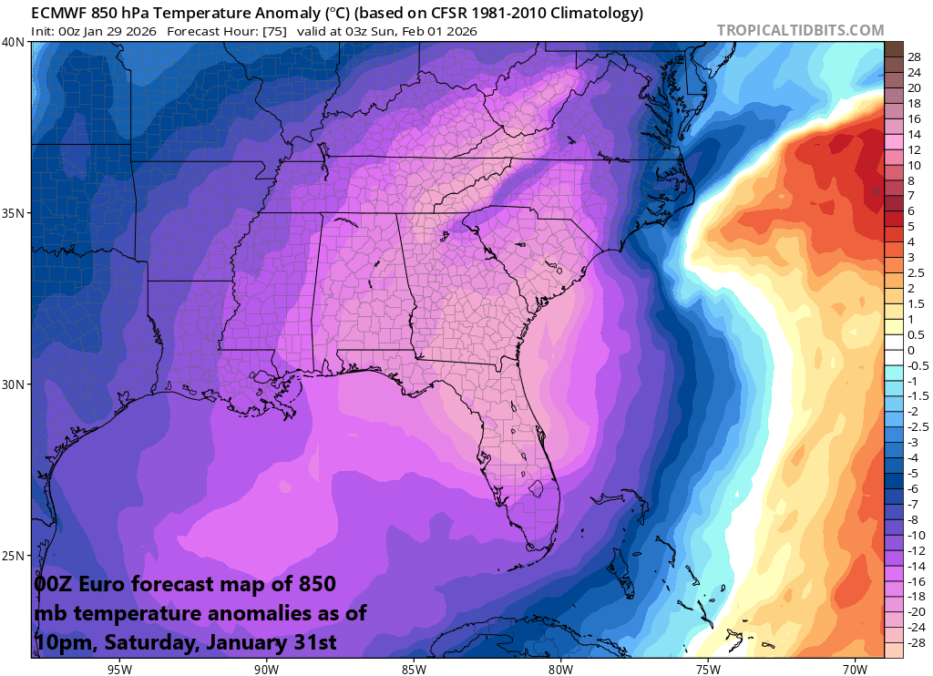
It was very cold this morning across Florida, but the coldest air mass is yet to come. Temperatures by Sunday morning should reach near freezing as far south as Miami…not far from their all-time lowest recorded temperature. Map courtesy ECMWF, tropicaltidbits.com
Bitter cold extends all the way down to Florida...
Bitter cold extends all the way down to Florida today with the low-to-mid 20’s this morning across portions of the “Sunshine State” and temperatures dropped to single digits in many Mid-Atlantic locations...the worst of the cold is yet to come in both parts of the country. In the Mid-Atlantic, overnight lows during the next couple of nights will be near or below zero in some locations and this risk includes those living inside the I-95 corridor. This kind of cold can result in record low temperatures in some spots as well as record low high temperatures. In Philly (PHL), for example, the low temperature record for January 30th (Friday) is 7 degrees set in 2019, and the record low high temperature is 18 degrees set in 1965...both are in jeopardy.
Farther to the south, temperatures dropped to the lower 20’s this morning across parts of northern Florida and their coldest weather is yet to come. The coldest core of the next Arctic air outbreak (relative-to-normal) will dive all the way down to Georgia, Alabama, and Florida this weekend and temperatures could flirt with the freezing mark in Miami by Sunday morning and perhaps again on Monday morning. (The all-time low temperature in Miami is 28 degrees which was recorded twice in 1947 and 1940).
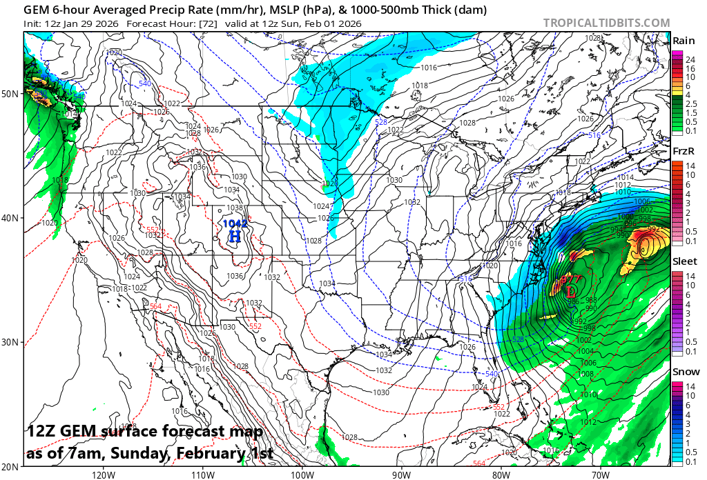
A powerful storm will form near the east coast this weekend and likely have a big impact across portions of the Carolinas, Virginia, and eastern New England as well. Map courtesy NOAA, tropicaltidbits.com
Now onto the weekend storm...
Explosive cyclogenesis will take place this weekend with the central pressure of a low-pressure system dropping dramatically between later Saturday and early Sunday. Low pressure will move near the Carolina coastline by later Saturday and then it’ll get juiced up by the phasing of a northern stream wave of energy and a southern wave. Another big contributing factor to the intensification of the storm system will be the sharp temperature gradient that it will encounter right near the coast with well below-normal water temperatures juxtaposed with warmer-than-normal Gulf stream water.
The biggest impact from this weekend storm will likely be across southern Virginia, the Carolinas, and eastern New England can get hit hard as well...all locations with snow and strong winds. The I-95 corridor from DC-to-Philly-to-NYC will not go unscathed as winds will pick up noticeably from later Saturday into Sunday and there can be some snow with small accumulations on the table.
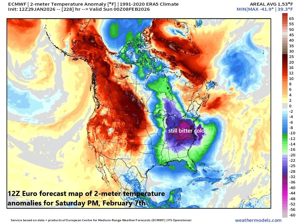
Looking ahead, it appears as though there will be no letup in this cold pattern for the eastern states. A look to next weekend, February 7th and 8th, features much below-normal conditions in the eastern US…much the same as it has been in recent weeks. Map courtesy ECMWF, weathermodels.com
Meteorologist Paul Dorian
Arcfield
arcfieldweather.com
Follow us on Facebook, Twitter, YouTube
Video discussion: