
***Unsettled weather pattern next few days includes enhanced severe weather risks and an impressive and impactful upper-level trough next week***
Paul Dorian
This week’s upper-level trough that slides across the northern states will be quite impactful and it’ll be replaced by another one - perhaps even stronger - during the early to middle part of next week. Map courtesy ECMWF, Weather Bell Analytics
Overview
Sometimes during the month of June, the jet stream retreats safely to the north into Canada, and the weather settles down across the continental US...that certainly does not appear to the case this year. Upper-level troughs of low pressure and colder-than-normal air masses continue to drop into the US from Canada, and this is resulting in severe weather outbreaks and there will be an enhanced threat during the next few days. Next week promises to feature another impressive upper-level trough by June standards that will no doubt be impactful with more severe weather threats and widespread cooler-than-normal conditions.
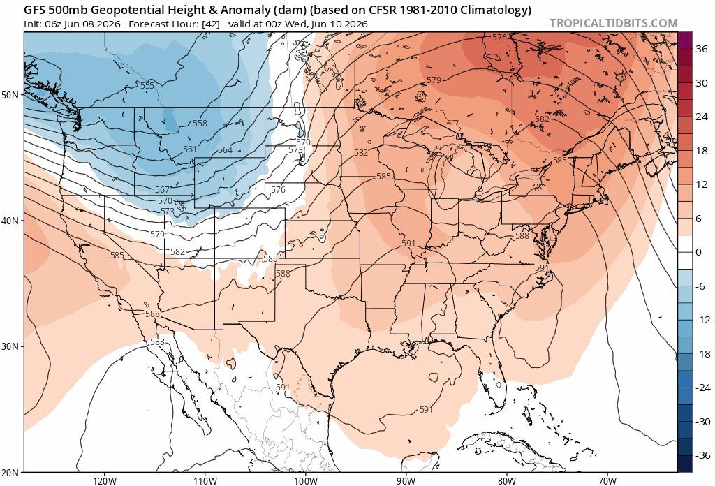
An upper-level trough of low pressure is sliding across the northern states and it is supporting numerous bands of showers and thunderstorms. Some of the storms will reach severe levels in the Wednesday-to-Friday time period from the Northern Plains to the Mid-Atlantic region. Maps courtesy NOAA, tropicaltidbits.com
Details
The threat of severe weather will become enhanced over the Northern Plains on Tuesday and then across the Middle and Upper Mississippi Valley regions on Wednesday and Thursday. The combination of moist air flowing northward from the southern states and a vigorous upper-level trough will create the instability required for severe weather and this same system could produce strong-to-severe thunderstorms later in the week across the Great Lakes, Ohio Valley and Northeast US. The hazards associated with the severe weather during the next couple of days will include frequent lightning, powerful wind gusts, hail and the possibility of tornadoes.
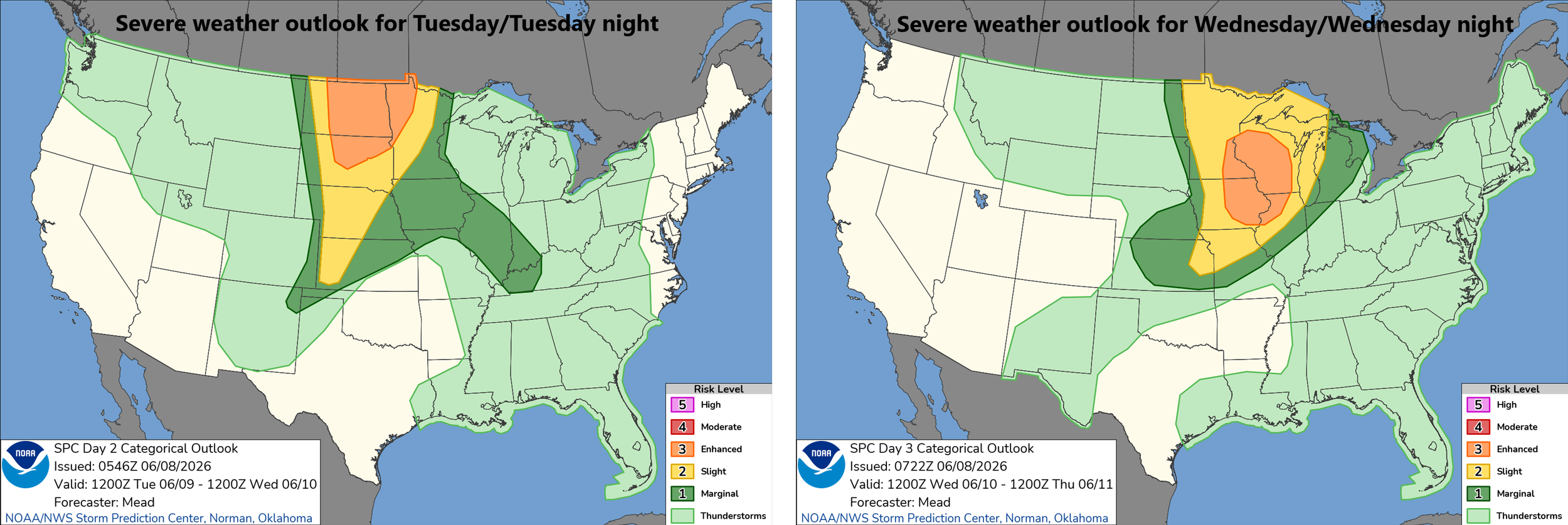
The threat of severe weather will be enhanced on Tuesday over the Northern Plains and on Wednesday across the Middle and Upper Mississippi Valley regions. Maps courtesy NOAA/SPC
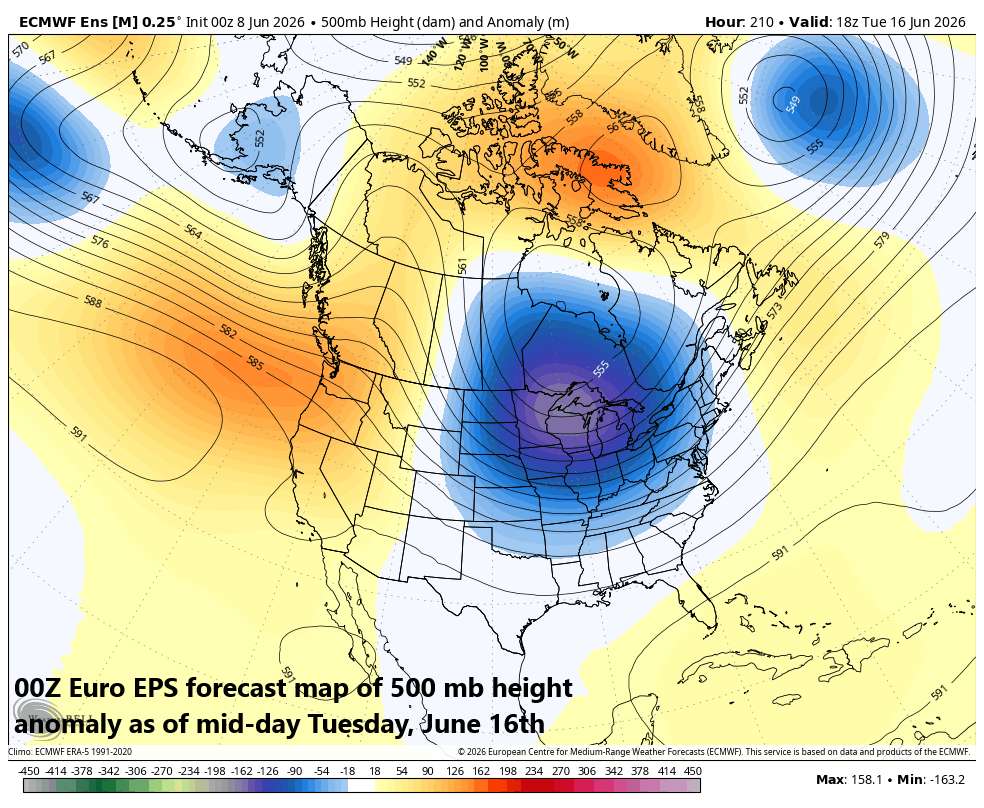
By early next week, another upper-level trough will become established over the central Plains and this one looks to become quite deep and widespread for this time of year...perhaps even stronger than the current system. As a result, look for a continuation of severe weather threats next week and likely a wide part of the nation will experience cooler-than-normal conditions for the middle of June.
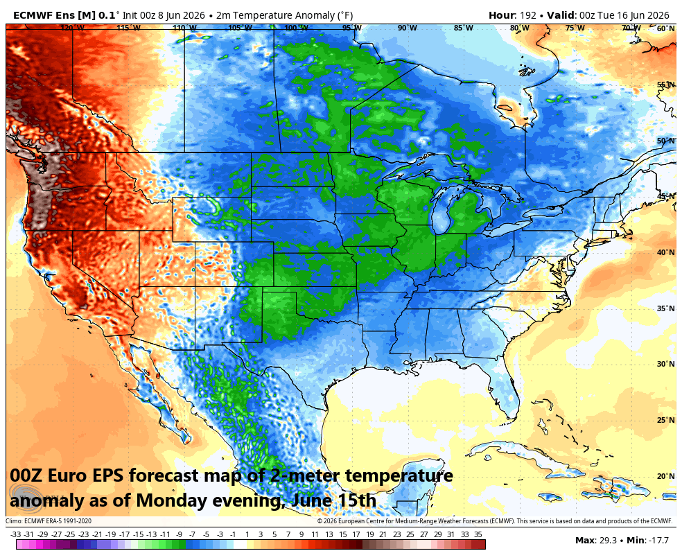
Next week could feature a widespread cooler-than-normal air mass across the eastern half of the nation with a deep upper-level trough of low pressure centered over the central states. Map courtesy ECMWF, Weather Bell Analytics
This unsettled weather pattern will likely result in a decent amount of rainfall for the eastern half of the nation during the next week to ten days which is good news for some areas in the south and east that are still experiencing dry soil conditions.
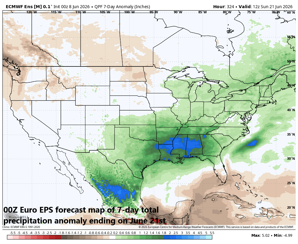
Next week could feature a decent amount of rainfall across much of the eastern half of the nation with a deep upper-level trough of low pressure centered over the central states. Map courtesy ECMWF, Weather Bell Analytics
Meteorologist Paul Dorian
Arcfield
arcfieldweather.com
Follow us on Facebook, Twitter, YouTube
Video discussion: