2:30 PM (Wednesday) | *Hurricane “Delta” a major threat to the north-central Gulf coast after pounding the Yucatan Peninsula…remnants to bring rainfall to much of southern and eastern US*
Paul Dorian
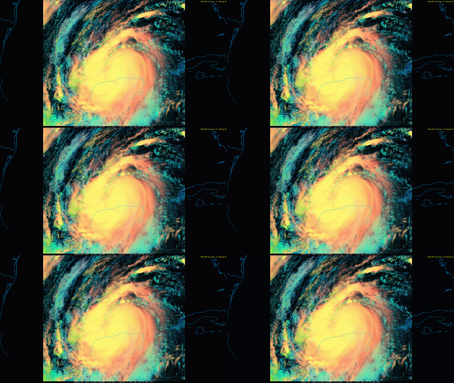
Hurricane “Delta” has now passed through the northeastern part of the Yucatan Peninsula and is entering the southern Gulf of Mexico. Images courtesy College of DuPage, NOAA
Overview
Hurricane “Delta” pounded the northeastern part of Mexico’s Yucatan Peninsula this morning as a category 2 storm and is now entering the southern part of the Gulf of Mexico. After its bump into with the Yucatan Peninsula, Hurricane “Delta” will encounter favorable conditions for intensification as it churns northwest over the still warm waters of the southern Gulf of Mexico in an environment with low wind shear and high moisture content. As such, Hurricane “Delta” is likely to re-intensify into “major” hurricane status as it heads on a path towards the north-central Gulf coast - and perhaps right to the same region that experienced the landfall of Hurricane Laura earlier this tropical season. After landfall likely on Friday, the remains of Hurricane “Delta” are then likely to push to the north and east bringing significant rainfall to the Deep South, Tennessee Valley and perhaps to the Mid-Atlantic region late in the upcoming weekend.
NOAA’s predicted storm track for Hurricane “Delta” which is likely to result in a direct hit right around the same area as Hurricane “Laura” earlier this tropical season (i.e., southwestern Louisiana). Map courtesy NOAA/NHC
Details
The sea surface temperatures in the Caribbean Sea and Gulf of Mexico are still quite warm this time of year and perhaps more importantly, atmospheric conditions will favor intensification of Hurricane “Delta” over the next 48 hours – likely back to “major” hurricane status (i.e., category 3 or higher). The latest observations feature a hurricane with maximum sustained winds of 100 mph, central pressure of 975 millibars, and a movement to the NW at 17 mph. Unfortunately, the weakening effects of “Delta’s” encounter with the Yucatan Peninsula are about to come to an end.
Cooler-than-normal water in the northern Gulf of Mexico could help to weaken Hurricane “Delta” in the hours preceding landfall likely on Friday in the north-central Gulf coastal region. Map courtesy NOAA, tropicaltidbits.com
Hurricane “Delta” will push northwestward over the next 24-36 hours around the southwestern portion of a subtropical ridge that extends over Florida and the northeastern Gulf of Mexico. After that, a developing mid-level trough over the south-central US should cause “Delta” to slow down and turn more to the north by later tomorrow and tomorrow night. By Friday, Hurricane “Delta” is quite likely to push right towards the southwestern part of Louisiana which is around the same area that was hit by Hurricane Laura earlier in August.
One of the residual impacts of Hurricane Laura was the churning of the waters in the northern Gulf of Mexico and this “upwelling” resulted in colder water from underneath to rise up to surface level. The resultant cooler-than-normal waters in the northern Gulf hopefully can result in some weakening in Hurricane “Delta” as it heads towards a landfall in the north-central Gulf coastal region. However, it is certainly still on the table that a “major” hurricane hit could happen in the north-central Gulf coastal region sometime on Friday.
After landfall in the north-central Gulf coastal region, Hurricane “Delta” could result in significant rainfall across the Deep South, Tennessee Valley and as far north and east as the Mid-Atlantic region. Map courtesy NOAA
Once “Delta” goes inland, it is likely to turn to the north and east and spread some significant rainfall to the Deep South and the Tennessee Valley. In fact, some the heavy rainfall associated with the remnants of Hurricane “Delta” could make it all the way into the Mid-Atlantic region by the late stages of the upcoming weekend. On a positive note, there is a chance that the Atlantic Basin turns quiet again in terms of overall tropical activity after the demise of powerful Hurricane “Delta”.
Meteorologist Paul Dorian
Perspecta, Inc.
perspectaweather.com
Follow us on Facebook, Twitter, YouTube


