***Severe weather/flash flooding today across the central Plains...same system pushes to the Mid-Atlantic region by Saturday with risk of downpours to head east...hot weather arrives next week***
Paul Dorian

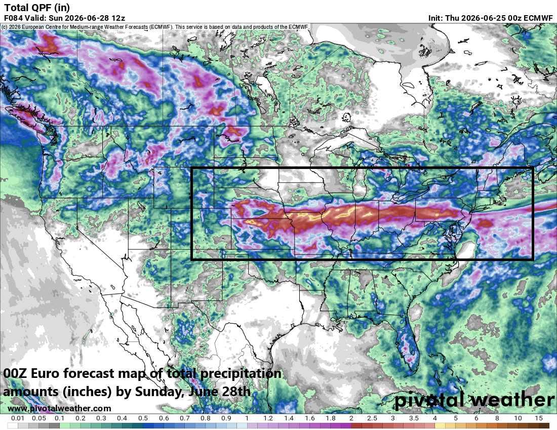
The total precipitation forecast map by the 00Z Euro features a west-to-east swath of significant rainfall between now and Sunday…extending all the way from the Central Plains to the Mid-Atlantic. Map courtesy ECMWF, Pivotal Weather
Overview
An overall active weather pattern across the nation will continue into the month of July and it is currently resulting in some severe weather across the central Plains and also the risk of flash flooding. In fact, the risks of severe weather and flash flooding will extend well to the east during the next few days and likely reach the Mid-Atlantic region at the start of the upcoming weekend. Low pressure and a painfully slow-moving frontal system will play key roles in the unsettled weather conditions into the weekend. Looking ahead to next week, hot weather will push into the DC-to-Philly-to-NYC corridor by Tuesday and high temperatures well up in the 90’s are likely in the big cities through the end of the work week.
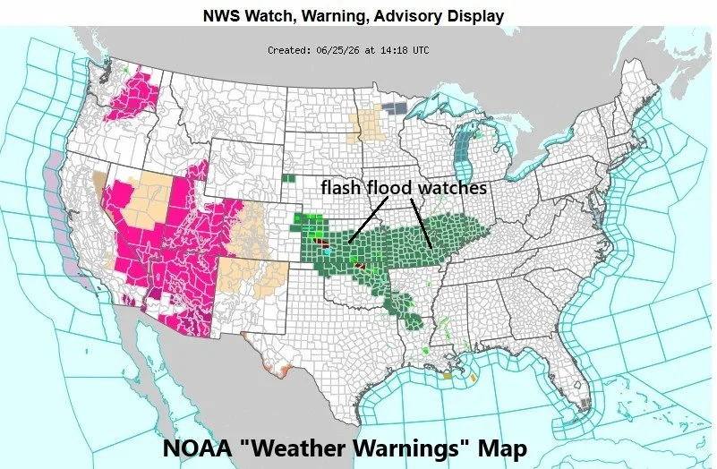
A widespread area features flash flood watches (in green) as issued by NOAA’s Weather Prediction Center. The flash flood watches may extend all the way to the Mid-Atlantic region by the upcoming weekend as low pressure rides along a nearly stationary frontal boundary zone. Map courtesy NOAA/WPC
Severe weather/flash flooding risks…Central Plains to the Mid-Atlantic region
Strong-to-severe thunderstorms are taking place today across the central Plains and the weather systems involved are contributing to a widespread area of flash flood watches as issued by NOAA’s National Weather Service and there are isolated flash flood warnings. In fact, flash flood watches have been issued all the way from the central Plains to the Ohio Valley, and I wouldn’t be surprised if they extend farther to the east to the Mid-Atlantic region by the weekend. Two key players in this unsettled weather pattern include strong surface low pressure and a frontal system that will become a playfully slow-mover during the next few days and a conduit for copious amounts of moisture to ride along in a west-to-east fashion.
The threat of showers and thunderstorms will actually increase later tonight in the Mid-Atlantic region and continue on Friday, but the best chance of rain may end up being on Saturday as low pressure heads this way from the middle of the country riding along the nearly stationary frontal boundary zone. The low pressure and frontal systems are likely to exit off the east coast by Sunday but a lingering shower or thunderstorm cannot be ruled out for the Mid-Atlantic region during the second half of the upcoming weekend.
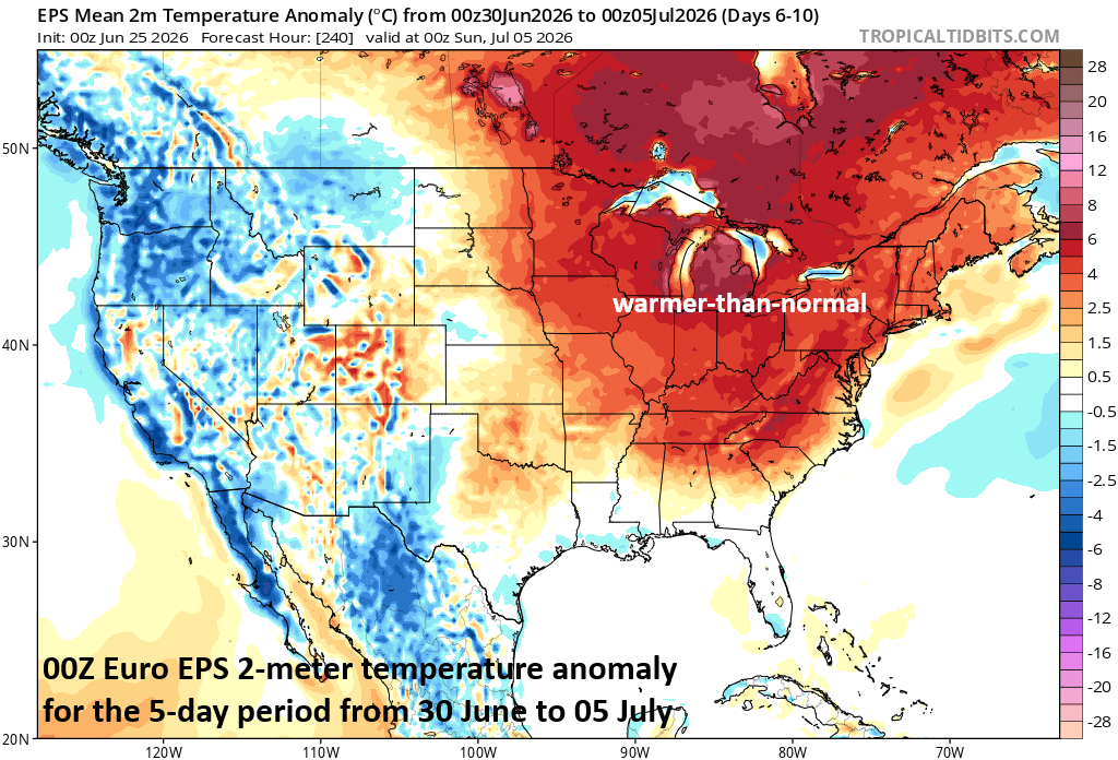
Hot weather is likely to arrive in the I-95 corridor on Tuesday and could last through the end of next week. Temperatures should reach well into the 90’s for afternoon highs in the big cities from DC-to-Boston as intense upper-level ridging of high pressure forms over the Great Lakes and southern part of Canada. Map courtesy ECMWF, tropicaltidbits.com
Hot weather advances to the eastern states next week
Looking ahead to next week, intense upper-level ridging will develop over the Great Lakes and southern part of Canada, and hot air will advance to the eastern states from southwest-to-northeast. Look for temperatures to climb well up into the 90’s along much of the I-95 corridor by Tuesday afternoon, and the high heat is likely to continue until the end of next week. As far as the 4th of July (Saturday) is concerned, it is a little too early to say if the high heat and humidity will linger in the I-95 corridor and coastal sections as there can be some (cooling) influence by then of low pressure sitting over the western Atlantic Ocean....something to monitor next week.
Meteorologist Paul Dorian
Arcfield
arcfieldweather.com
Follow us on Facebook, Twitter, YouTube
Video discussion: